Quattro Group
ClimbPlan Project
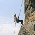
About The ClimbPlan Project
For the last 20 years Geographic Information Systems have had a big role in the daily life. In contemporary life, GIS systems are used in several aspects such as scientific investigations, resource management, asset management, archaeology, environmental impact assessment, urban planning, cartography, criminology, geographic history, marketing, logistics etc. more and more. . This shows the growth of the importance of GIS technologies in everyday life. It will have a more widespread usage in real life in the future because it is a technology that concerns lots of important aspects of life. However, there has been a lack in software solutions for assistance for climbers in finding their safe routes during climbing their target mountain. Since climbing a mountain requires a great amount of careful planning, the assistant software should be very accurate and should consider the requirements of the climbers. This project is aiming to develop climbing assistant software that meets the mentioned criteria in order to make up for the deficiency in the market.